I had a very enjoyable time at WhereCamp5280. A huge thanks should go to Eric Wolf, Peter Batty, and Ben Tuttle. I think one of the best parts of the WhereCamp was the practicality of what was presented. So much we get fluff at Where 2.0 or other “bleading edge” conferences of projects and companies that aren’t really trying to solve problems. All I saw last weekend was person after person talk about what they were doing with their workflows with some great technology and the end result was an improvement in their services.
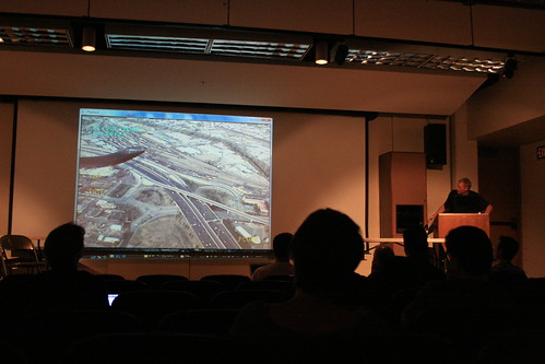
That isn’t to say that there wasn’t cutting edge stuff there, Chris Helm showing CouchDB and IMBY, DRCOG, their data portal and using OSM, Ben Tuttle using IDL and Ruby at NOAA and Tom Churchill showing how Denver PD uses augmented reality mapping to help them catch criminals. It isn’t just that rolling MapReduce is “fun”, but it needs to be practical and that is what I think the Denver geospatial community is great at doing.
What also could be happening is that we are crossing over from thinking about using these technologies and are actually using them in our everyday workflows. I’m not sure WhereCamp5280 could have been any more successful than it was and I’m looking forward to the next WhereCamp (WhereCampPDX?).
**Tom Churchill demonstrates augmented reality application from the Denver PD helicopter. **